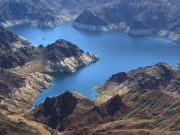
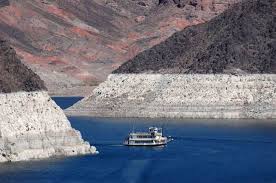
GET VISIBLE! Advertise Here. Find Out More


.

Dropping Lake Mead Water
Level A Grave Concern


By Ted Twietmeyer
8-19-14


White band of rock around the lake shows past water level.


While parts of the northeast have been swamped by record rainfall in the summer of 2014, Lake Mead water level in Nevada is steadily dropping. This does not appear this is global warming when heavy rain still comes down, but falls in unexpected places. Dropping water level of Lake Mead has become such a great concern 
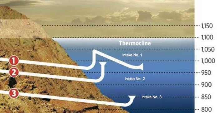
to future Hoover Dam power generation that a new water intake tunnel costing many millions of dollars is being drilled. Unfortunately, the new deeper intake tunnel is approximately 30 months behind schedule due to tunnel boring machine mechanical issues.


Statistics showing the depth of existing tunnels 1 and 2, and proposed plan for tunnel 3.


Lake Mead is about 24 mi (39 km) from the Strip southeast of Las Vegas, Nevada, in the states of Nevada and Arizona. Formed by the Hoover Dam, it is 112 miles (180 km) long when the lake is full, has 759 miles (1,221 km) of shoreline, is 532 feet (152 meters) at greatest depth, with a surface elevation of 1,221.4 feet (327.3 metres) above sea level. It has 247 square miles (640 km2) of surface, and when filled to capacity, 28 million acre-feet (35 km3) of water. However, the lake has not fully reached this capacity since 1983 due to a combination of drought and increased water demand. [1]


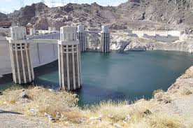
Upstream side of Hoover Dam showing how far water has dropped. It has looked like this since 2009.


Another view of the water level drop


Super fishing ­ incredible large-mouth bass reside in Lake Mead

Ted Twietmeyer

tedtw@frontiernet.net


[1] http://en.wikipedia.org/wiki/Lake_Mead


Disclaimer


Donate to Rense.com Support Free And Honest Journalism At Rense.com
Subscribe To RenseRadio! Enormous Online Archives, MP3s, Streaming Audio Files,  Highest Quality Live Programs


<