| Back to... |
|
 | |
| Share Our Stories! - Click Here | |
|
La Palma Quake Grid Pattern Explained | |
|
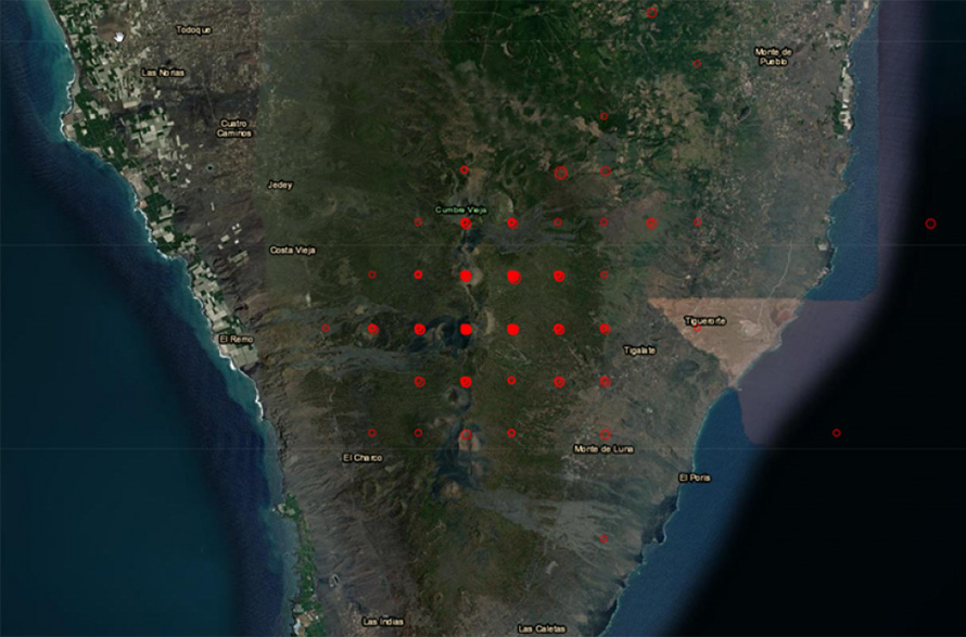
Thanks to Mike S for getting clarification regarding the earthquake grid pattern in the area of the Cumbre Vieja volcano. This does not in anyway dismiss the amazing numbers of quakes occurring, it only explains how they are represented on the EMSC map...in fact, there have already been over 275 quakes near and under the volcano just today. From m.c. - emsc-csem.org Sent: Monday, October 25, 2021 12:01 AM To: Mike S Subject: RE: Earthquake map question, grid pattern? Dear User, Thank you for writing to us about this matter. We have received many questions about the seismic activity in La Palma island displayed on our maps. The "grid" of earthquake locations is an artifact of how EMSC rounds longitude and latitude coordinates to two decimal points. We take this occasion to explain why the EMSC map displayed a grid pattern of earthquake locations in La Palma island. If you look at the longitude and latitude data provided by EMSC ( https://www.emsc-csem.org/#2 ) , you will see that there are two decimal points in each value, resulting in a less-granular, less-defined dataset. As a way of example, Google Earth uses 6 decimal points for the lon/lat couples. This allows for exponentially more granularity, which results in a higher-definition display. In tight earthquake clusters like the ones occurring in La Palma, when you zoom way in, the 2 decimal point approximation creates an artifact and the earthquake locations are displayed like a grid.
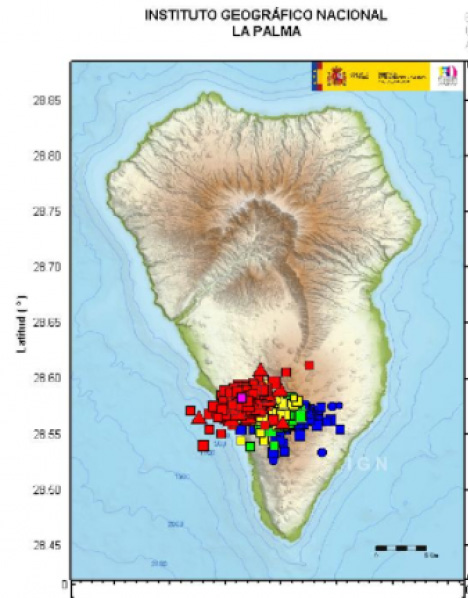
This is not unique to La Palma. It happens everywhere on our maps, whenever there is a huge zoom on a very small area. In La Palma, the artifact is more pronounced because of the very small size of the island. IGN, the authoritative source for seismic information in Spain, does not round the coordinates, and the seismicity does not look like a grid on their map: http://www.ign.es/web/ resources/sismologia/ tproximos/prox.html .
We recommend consulting the local sources for tight seismicity like the one we are observing in La Palma. Instituto Geográfico Nacional, IGN Website: http://www.ign.es/ web/ign/portal Twitter: @IGN_Sismologia) Instituto Volcanológico de Canarias Website: https://www.involcan. org/ Twitter: @involcan) We are sorry for this misunderstanding and are glad of this opportunity to exchange with you and better explain our services. Best regards, The EMSC team
|